Spatial data
General datasets
CORINE Land Cover
Composition of current and historical CLC datasets
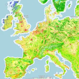
CORINE Land Cover (CLC) product offers a pan-European land cover and land use inventory with 44 thematic classes, ranging from broad forested areas to individual vineyards. The product is updated with new status and change layers every six years—with the most recent update made in 2018.
Imperviousness Density
Composition of imperviousness density time series datasets
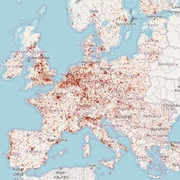
This map composition contains Copernicus High Resolution Layer Imperviousness Density status layers for the reference years 2006-2024. The dataset represents the degree of imperviousness or artificial soil sealing as percentage values from 0 to 100%. The composition supports visual assessment of sealed surfaces, built-up areas, land take and urbanisation patterns across Europe.
Tree Cover Density
Composition of tree cover density time series datasets
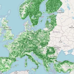
Map composition comparing Copernicus High Resolution Layer Tree Cover Density datasets across selected reference years. The layers show proportional tree crown cover per pixel and support visual assessment of tree cover patterns and changes across Europe.
Grassland
Composition of grassland status time series datasets
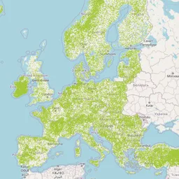
Map composition comparing Copernicus High Resolution Layer Grassland status datasets across selected reference years. The layers distinguish grassland from non-grassland areas and support visual assessment of grassland distribution and temporal changes across Europe.
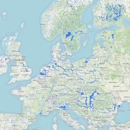
Potential Flood-Prone Areas
Composition of potential flood-prone areas across Europe
Map composition presenting the EEA Potential Flood-Prone Area Extent dataset. The layer shows areas that may be affected by a 100-year flood event and supports visual assessment of flood exposure, climate adaptation needs and land-use planning constraints across Europe.
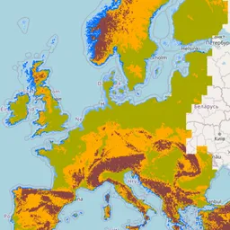
Elevation Breakdown
Composition of elevation-based landscape zones across Europe
Map composition presenting the EEA Elevation Breakdown layer derived from EU-DEM. The layer defines homogeneous terrain zones based on elevation, slope and distance to the sea, supporting interpretation of land use and landscape patterns across Europe.
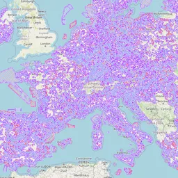
Natura 2000 Protected Sites
European protected sites designated under the Habitats and Birds Directives.
Map composition presenting Natura 2000 protected sites across Europe, including areas designated under the Habitats Directive and Birds Directive. The layers support visual assessment of biodiversity conservation areas and potential land-use planning constraints.
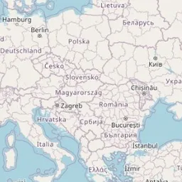
Interactive map playground
Online application to view and compose maps
Full featured web mapping application that allows to browse and view all the available geo-data sets and maps. You can also compose your own maps and share with others.
Practice cases
Practice Case Three-Countries Park
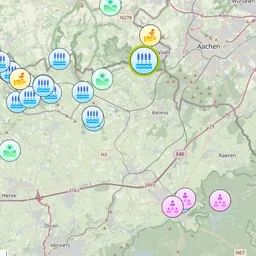
Online Map on Nature-based solutions in the Euregio Meuse-Rhine
The aim of this Nature-based solutions-webmap is to collect information on
(implemented/planned/missing) nature-based solutions within the PlusChange project area. The map also serves as a working document to have a
geographic overview of the implemented/planned projects, so that the areas where measures are still needed can be seen more easily.
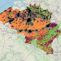
Landsystems scenarios - Belgium
Visualisation of different landscape scenarios
Selected new land use types
The map presents the selected new land use types in regions of practice cases
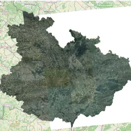
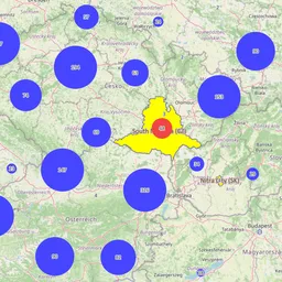
Practice case - South Moravia
Comparing orthophoto
Map composition comparing different orthophotos from national agency